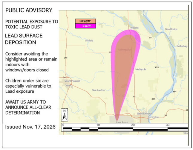
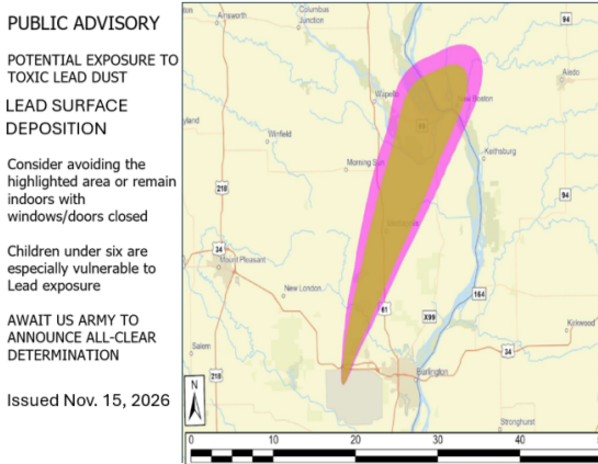
An updated map released late Wednesday of a roughly 30-mile area that could be exposed to toxic lead dust settling on surfaces from the planned detonation of lead azide on Friday.
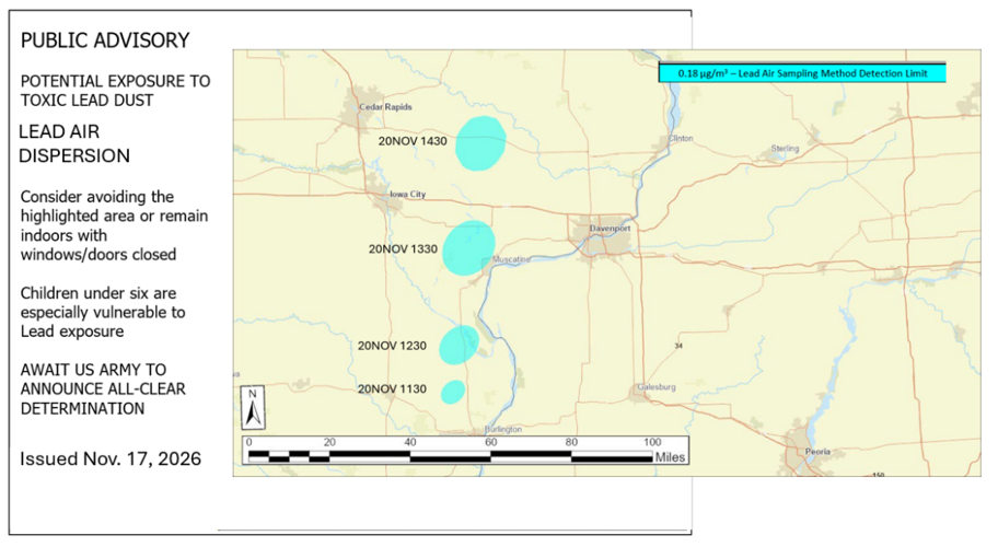
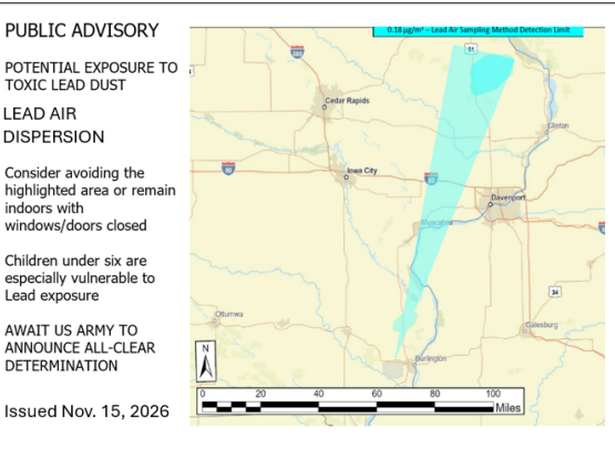
An updated map released late Wednesday night from the U.S. Army modeling potential exposure of lead particles in the air from a detonation of lead azide on Friday.
The map shows a projected airborne lead exposure area from a controlled detonation in Middleton, Iowa, scheduled for Friday, Nov. 20, 2026.
U.S. ARMY
The map shows projected surface exposure to lead following a controlled detonation in Middleton, Iowa, on Friday, Nov. 20, 2026.
Update 11/19 6:31 p.m.: the acting U.S. Secretary of the Army postponed the detonation until Monday, Nov. 23. Updated dispersion maps for Monday's conditions have not yet been released, though preliminary forecasts appear to show winds blowing a different direction — toward the south instead.
An updated map released late Wednesday of a roughly 30-mile area that could be exposed to toxic lead dust settling on surfaces from the planned detonation of lead azide on Friday.
An updated map released late Wednesday night from the U.S. Army modeling potential exposure of lead particles in the air from a detonation of lead azide on Friday.